Travel Planner
“The Best Hiking Trails in the Midwest”
Episode #1809 Travel planner
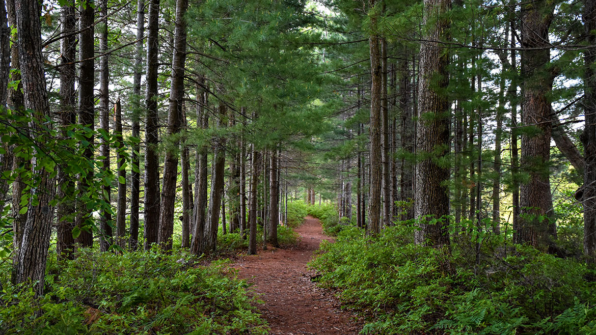
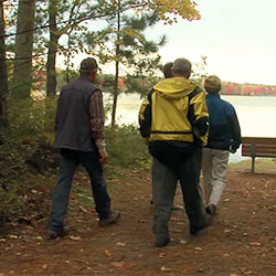
If you like to hike, today’s show is for you. We have picked our favorite trails across the Midwest and Canada and put them together for your hiking enjoyment.
Free Guide
Tell us what you thought of this episode and get information and guides to the areas by filling out the comment form
Comment Form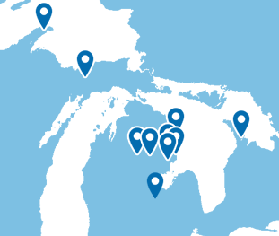
Michigan and Ontario
Bruce Trail
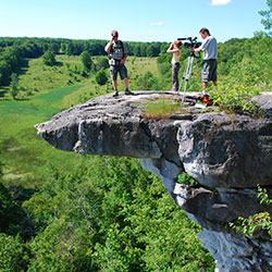
Location: southern and central Ontario, Canada
Running along the Niagra Escarpment from Niagara to Tobermory, the Bruce Trail spans more than 890 km of main Trail and over 400 km of associated side trails.. The Bruce Trail is Canada's oldest and longest footpath. Many sections cross private land, and courtesy is a keynote to trail use. Grey County has 250 km of the Bruce Trail in its own backyard. The Bruce County section of The Bruce Trail begins in Wiarton and winds its way up the east side of the Peninsula to Tobermory. For most of its length the trail is a rugged footpath and in numerous situations it provides spectacular views over Georgian Bay. Along its path there are side trails and access trails. There are numerous opportunities to complete relatively short hikes that form loops by using segments of the main trail and a side trail.
- The Bruce Trail [Explore The Bruce]
- Bruce Trail Hikes [Grey County]
- The Bruce Trail Conservancy
Montreal River Hike
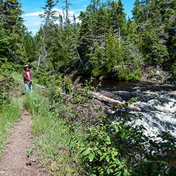
Location: tip of the Keweenaw Peninsula, Michigan
ECO-INTERPRETIVE HIKING TOURS
Location: Copper Harbor, Michigan
Phone: (906) 289-4303
Montreal River Mouth Eco-Interpretive Hiking Tour - A Waterfall to "Wow" You (4hr) The Montreal River pushed its way between the lava flows which forms the Keweenaw until it found a crack and a long cascade down to Lake Superior. This three mile hike takes you to the upper falls where the entire river drops 50 foot through a notch in the ridge. Then follow the rivers spectacular run to the Lake. The most remarkable water falls you will ever see!
- Charles Eshbach [Keweenaw Adventure Company]
- Eco-Interpretive Hiking Tours [Keweenaw Adventure Company]
- Montreal Falls [Keweenaw Peninsula]
Marl Lake Trail
Location: 106 State Park Drive - Roscommon, MI 48653
Phone: (989) 821-6374
3 Trail Loops: Green Trail (2 Miles), Red Trail (3.5 Miles), Blue Trail (5.5 Miles)
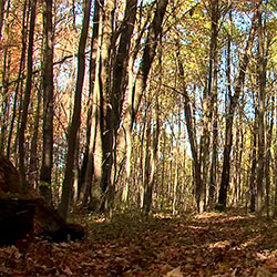
To the south lies Marl Lake, more wildness, and better wildlife viewing. The Marl Lake portion of the South Higgins Lake State Park is about 700 acres and includes Marl Lake and a small boat launch with vault toilets. This area is also the parking area and trail head for the five mile hiking trail along and around the west and south shores of Marl Lake. The Marl Lake upland is forested with oak, maple, and pine predominating with some white birch, ash, and other species mixed in.
- Hiking [Visit Houghton Lake]
- South Higgins Lake State Park - Marl Lake Trails [Michigan DNR]
- Marl Lake Map
Ogemaw Hills Pathway
Location: Clear Lake Road & Fairview Road - West Branch, MI 48661
In terms of forest cover types the area varies from large expanses of jack pine on the sandy plains, to low conifer swamps. The tree species are primarily associations of jack pine, red pine, and black oak, in the sandy areas. Finally on the ridges along the higher elevations bigtooth aspen and red oak are found on the better quality soils. Much of the state forest land originated after the large forest fires during the early 1900's, and many areas were replanted by the Civilian Conservation Corps.
- Ogemaw Hills Pathway [Visit West Branch]
- Ogemaw Hills Pathway Map 2.17mb
Highbanks Trail / Eagle Run Trails
HIGHBANKS TRAIL
Location: 7 Mile trail located along the AuSable River. Latitude 44.627315, Longitude -84.512476
Hours: Open year round.
EAGLE RUN TRAILS
Location: 6.8 Miles of Trails on River Road 2.5 miles west of Oscoda. Latitude 44.425669, Longitude -83.366232
Hours: Open year round
Contact: Huron Shores Ranger Station (989) 739-0728
The Highbanks Trail System is a scenic back-country linear trail system with views of the AuSable River Valley. From the high bluffs of the south shore of the AuSable River, many species of plants, animals and songbirds may be viewed in their natural setting. The trail system offers excellent opportunities to experience and enjoy nature.
The Eagle Run Trails run along the south shore of the Lower AuSable River. Eagle Run provides a loop trail system for hiking and cross-country skiing. Scenic views of the AuSable River and a quiet, remote setting allow visitors to experience nature first hand. The trails are maintained with the support of volunteers.
- Highbanks River Trail [Huron National Forest]
- Highbanks Hiking & Ski Trail System - Map 1.12mb
- Eagle Run Pathway [Huron National Forest]
- Eagle Run Pathway - Map 347kb
Colwell Lake Trail
Location: 30 Miles North of Manistique just off of M-94
Colwell lake is 145 acres with an excellent swimming beach and boat access. Camping, fishing, picnicking and hiking are other popular recreation activities at Colwell Lake. The Colwell Lake Trail begins at the boat launch parking lot. This natural surface, nature trail is 1.6 miles long and crosses through a variety of northern hardwood stands and wetlands. The trail has several areas where stairs or plank boardwalks are traversed.
- Colwell Lake Hiking Trail [Hiawatha National Forest]
- Colwell Lake Trail Map [Visit Manistique]
Corsair Trails
Location: off of Monument Road, Tawas City, MI
Hours: Open year round
Contact: Huron Shores Ranger Station (989) 739-0728
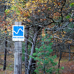
Corsair Trail has 28.3 miles of one-way trail that varies from gently rolling, easy terrain to somewhat hilly, most difficult terrain. The trails may be hiked anytime during the snow-free periods. The trails are marked with blue diamond-shaped confidence markers.
- Corsair Trail System [Huron National Forest]
- Corsair Trail System [Tawas Bay Area]
Negwegon State Park

Location: About 35 Miles North of Oscoda via US-23
Contact: Harrisville State Park (989) 724-5126
Hours: Open year round
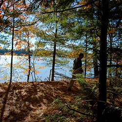
Negwegon State Park is a rustic, undeveloped area open for hunting, walk-in camping and hiking. The terrain is a mixture of low land areas, with small ridges, to mature pine forest, with some hardwoods and aspen forest, with some pockets of open meadows mixed in. Negwegon hosts a beautiful undeveloped sandy beach on Lake Huron. Please use caution when visiting Negwegon as the roads into the park are often so sandy that a four-wheel drive vehicle is needed. Motorized vehicles are not allowed on the trails or off-road.
- Negwegon State Park [Michigan DNR]
- Negwegon State Park Map 972kb
- Negwegon State Park Backcountry Guide 274kb
Shiawassee National Wildlife Refuge Hiking Trails
Location: Shiawassee National Wildlife Refuge is located in Saginaw County, Michigan. The refuge’s headquarters is located about 5 miles south of Saginaw off of highway M-13 on the corners of Curtis and Mower Roads. 6975 Mower Road - Saginaw, MI 48601
Phone: (989) 777-5930
Office Hours: 7:30am - 4pm, Monday – Friday and closed all federal holidays
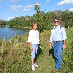
The refuge spans 9,501 acres of bottomland-hardwood forests, rivers, marshes, managed pools, fields and croplands. It lies just south of the City of Saginaw. Located in the MIssissippi Flyway, the Refuge hosts over 270 species of birds each year. Thousands of ducks, geese and other waterfowl stop to refuel at the Refuge during the spring and fall migration. The American Birding Association designated the Refuge a "U.S. Important Bird Area" because of the southern James Bay Canada geese that use the Refuge. Thousands of people visit the refuge each year to enjoy its diverse wildlife and habitats.
The refuge offers several trail systems that highlight the unique features of the area. Trails are open year round except for days during hunting periods. Outside of hunting closures, trails are open seven days a week, during daylight hours only. No pets or horses are allowed on any of the trails.
- Shiawassee National Wildlife Refuge [U.S. Fish & Wildlife Service]
- Shiawassee National Wildlife Refuge Trails Map 494kb
Trail Country - Vote For Your Favorite
You have seen all the ways to explore the rivers and lakes, which would you choose for your adventure on one of our favorite trails?
Would you pick Cowell Lake trail for its ease and beauty or would you prefer a leisurely trip through the Shiawassee Wildlife Refuge? How about an adventure on the Corsair Trails or are you the adventurist type and want to hike the backwoods along Lake Huron in the Negwagon State Park?
If you love fishing your choice is going to be the trip along the AuSable on the Eagle Run Pathway. Maybe your dream is a overnight hike or one of the other trails you've seen on today's episode.