Travel Planner
“Our Favorite Hikes”
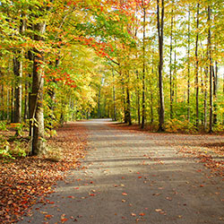
Episodes #2103 and #2104 Travel Planner
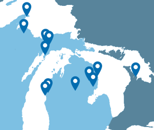
We have hiked in so many great places that we couldn’t bring them all to you in one show. Today we will concentrate on Michigan’s Lower Peninsula and Canada including the Huron Manistee National Forest.
This is part 2 of our favorite hikes and it takes us to the Upper Peninsula and beyond. So, grab your boots and watch as we head into the back country with part 2 of our favorite hikes.
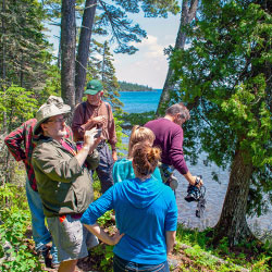
Ontario / Michigan
Bruce Trail
Location: southern and central Ontario, Canada
Running along the Niagra Escarpment from Niagara to Tobermory, the Bruce Trail spans more than 890 km of main Trail and over 400 km of associated side trails.. The Bruce Trail is Canada's oldest and longest footpath. Many sections cross private land, and courtesy is a keynote to trail use. Grey County has 250 km of the Bruce Trail in its own backyard. The Bruce County section of The Bruce Trail begins in Wiarton and winds its way up the east side of the Peninsula to Tobermory. For most of its length the trail is a rugged footpath and in numerous situations it provides spectacular views over Georgian Bay. Along its path there are side trails and access trails. There are numerous opportunities to complete relatively short hikes that form loops by using segments of the main trail and a side trail.
- The Bruce Trail [Explore The Bruce]
- Bruce Trail Hikes [Grey County]
- The Bruce Trail Conservancy
Negwegon State Park
Location: About 35 Miles North of Oscoda via US-23
Contact: Harrisville State Park (989) 724-5126
Hours: Open year round
Negwegon State Park is a rustic, undeveloped area open for hunting, walk-in camping and hiking. The terrain is a mixture of low land areas, with small ridges, to mature pine forest, with some hardwoods and aspen forest, with some pockets of open meadows mixed in. Negwegon hosts a beautiful undeveloped sandy beach on Lake Huron. Please use caution when visiting Negwegon as the roads into the park are often so sandy that a four-wheel drive vehicle is needed. Motorized vehicles are not allowed on the trails or off-road.
- Negwegon State Park [Michigan DNR]
- Negwegon State Park Map 972kb
- Negwegon State Park Backcountry Guide 274kb
Hoist Lake Foot Travel Area
Location: Latitude: 44.655249, Longitude: -83.837975
Hoist Lake foot travel area encompasses almost 10,000 acres of pine, aspen and hardwood forest. There are 19 miles of looped trail. Hiking trails and back-country skiing are permitted; however, there are no groomed trails. Hiking ranges from moderate to more difficult/most difficult. Hunting and fishing are permitted in season.
- Hoist Lake Area [Huron National Forest]
- Hoist Lakes Trail System [Huron National Forest]
Corsair Trails
Location: off of Monument Road, Tawas City, MI
Hours: Open year round
Contact: Huron Shores Ranger Station (989) 739-0728
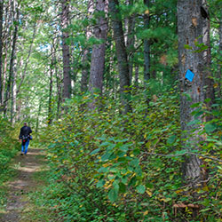
Corsair Trail has 28.3 miles of one-way trail that varies from gently rolling, easy terrain to somewhat hilly, most difficult terrain. The trails may be hiked anytime during the snow-free periods. The trails are marked with blue diamond-shaped confidence markers.
- Corsair Trail System [Huron National Forest]
- Corsair Trail System [Tawas Bay Area]
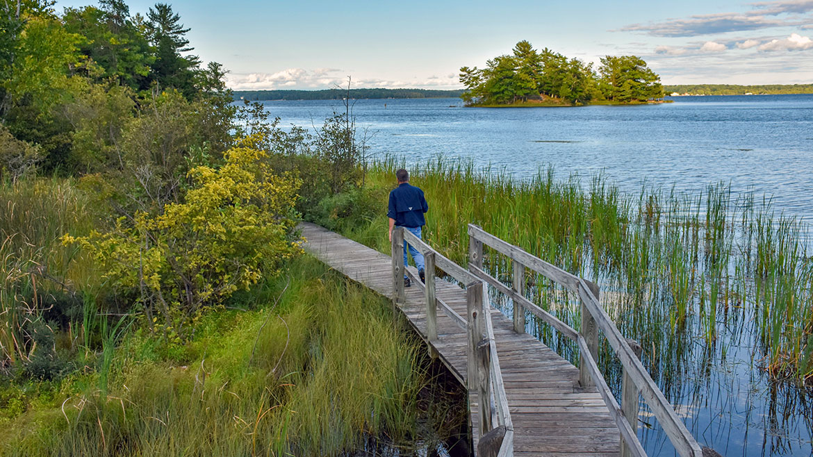
Nordhouse Dunes Wilderness Area
Size: 3,450 acres of National Forest
Location: Lake Michigan Shore, North of Ludington State Park (44.087486, -86.444676)
Phone: Cadillac / Manistee Ranger District (231) 723-2211
The Nordhouse Dunes Wilderness Area is a Federally designated wilderness in Michigan's lower peninsula and encompasses 3,450 acres of National Forest. The wilderness area is popular for hiking, camping, hunting, nature study and wildlife viewing. There are approximately 10-miles of trail that can be accessed from 2 developed trailheads at the end of Nurnberg Road and Lake Michigan Recreation Area.
- Nordhouse Dunes Wilderness Area [Huron/Manistee National Forest]
- Nordhouse Dunes Wilderness Area [USDA Forest Service 5.35mb]
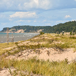
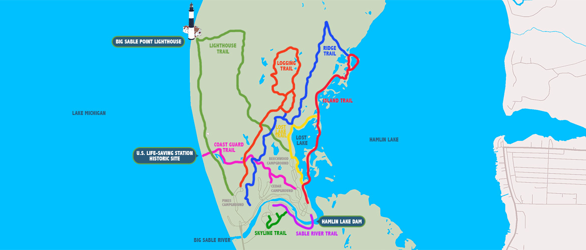
Ludington State Park
Location: 8800 W. M-116 - Ludington, MI 49431
Size: 5300 Acres
Phone: (231) 843-2423
Hiking Trails: 21.50 Miles
Ludington State Park is a favorite destination for hikers, fisherman, bikers, paddlers and campers. The park is home to three campgrounds, scenic sand dunes, an iconic lighthouse, marshlands, beaches and hardwood forests. The park is situated between seven miles of Lake Michigan shoreline and Hamlin Lake.
Ludington State Park is comprised of scenic sand dunes, beaches, an iconic lighthouse, ponds, marshlands and forests. It is situated between Hamlin Lake and Lake Michigan with several miles of shoreline and beaches on both bodies of water.
- Ludington State Park [Michigan DNR]
- Ludington State Park - Map [Michigan DNR 230kb]
- Ludington State Park Hiking Trails [Michigan DNR 295kb]
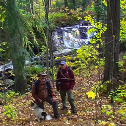
Lost Twin Lakes Pathway
Location: AuSable State Forest | 7 miles south of Houghton Lake via M-55 & S Reserve Road (County Road 401)
Trail Length: 3.3 Miles
Phone: (989) 821-6125
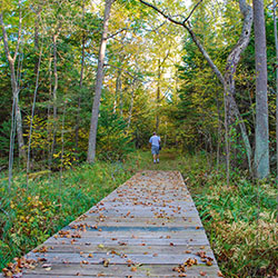
The main attraction along the Lost Twin Lakes Pathway is its century-old white pines that can be seen along the trail. The 3.3-mile looped pathway takes hikers and bicyclists through the rugged area of Lost Lakes and features a varied of topography that includes ridges, wetlands and swamps. There are boardwalks that cover the wettest areas. It is located just south of Houghton Lake in Roscommon County. The pathway is managed by North Higgins Lake State Park.
- Houghton Lake Area Hiking [Houghton Lake Tourism]
- Lost Twin Lakes Pathway [Michigan DNR]
- Lost Twin Lakes Pathway Map [Michigan DNR] 2.17mb
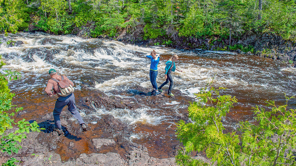
Montreal River Hike
Location: tip of the Keweenaw Peninsula, Michigan
ECO-INTERPRETIVE HIKING TOURS
Location: Copper Harbor, Michigan
Hours: (906) 289-4303
Montreal River Mouth Eco-Interpretive Hiking Tour - A Waterfall to "Wow" You (4hr) The Montreal River pushed its way between the lava flows which forms the Keweenaw until it found a crack and a long cascade down to Lake Superior. This three mile hike takes you to the upper falls where the entire river drops 50 foot through a notch in the ridge. Then follow the rivers spectacular run to the Lake. The most remarkable water falls you will ever see!
- Charles Eshbach - Eco-Interpretive Hiking Guide [Keweenaw Adventure Company]
- Eco-Interpretive Hiking Tours [Keweenaw Adventure Company]
- Montreal Falls [Keweenaw CVB]
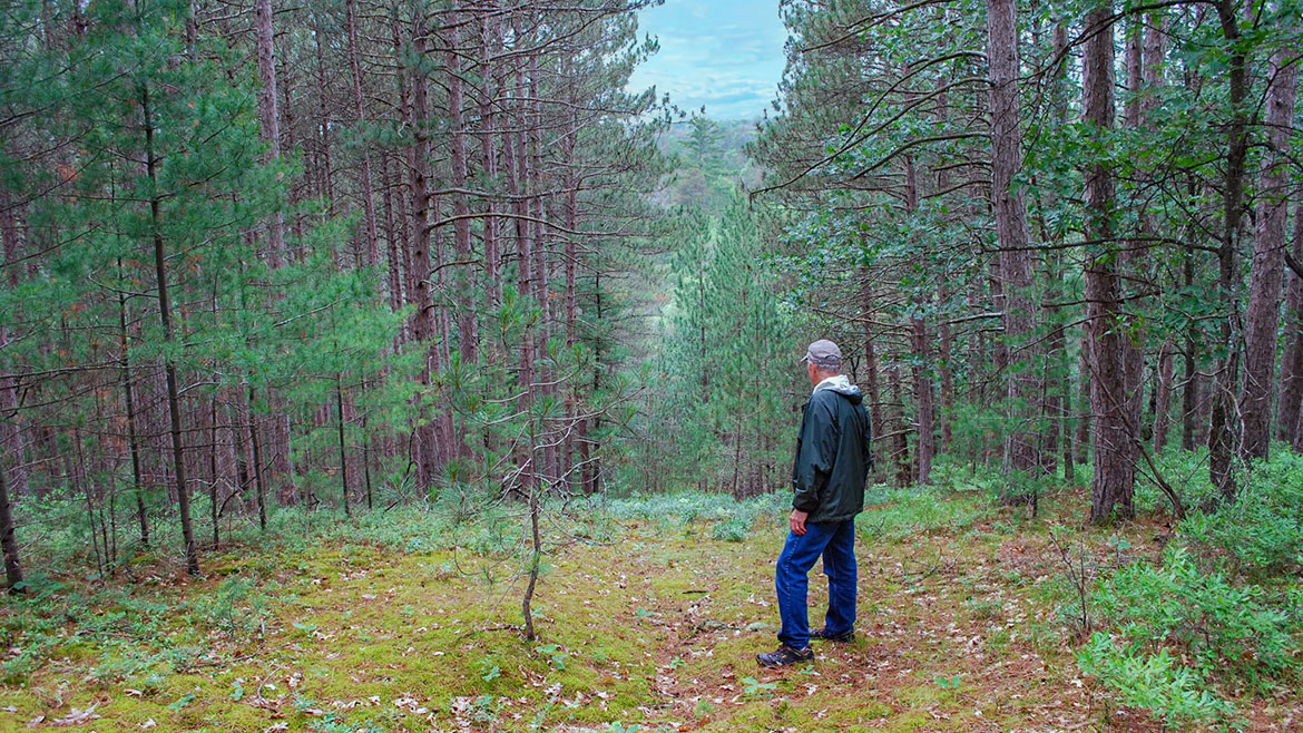
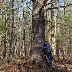
McCormick Wilderness
Location: Ottawa National Forest | NW of Marquette MI
McCormick Wilderness has recovered from the logging era that ended in the early 1900s. Today, you'll find a mixture of northern hardwoods and lowland conifers interspersed with small patches of towering white pine, Michigan's State Tree. Straddling the divide between Lake Superior and Lake Michigan, this region ranges from nearly level terrain to rocky cliffs. McCormick's water is what draws most visitors, with the Huron, Dead, Pahokee, and the Wild and Scenic Yellow Dog Rivers all have part of their headwaters within the wilderness. Many cascading waterfalls on the Yellow Dog make it unnavigable. The Yellow Dog is one of a few Eastern rivers designated "Wild". Eighteen small lakes add sparkle to the landscape. Trout, pike, and bass live here, but only in small numbers due to the less-than-fertile-waters. The three mile White Lake Trail connects County Road 607 to White Deer Lake where the McCormick Estate once stood. Remnants of old, unmaintained trails can sometimes be found, but the rest of the Wilderness is fairly rugged, isolated, unspoiled, and relatively difficult to access.
- Yellow Dog Falls [Ottawa National Forest]
- McCormick Wilderness [Ottawa National Forest]
Fayette Historic State Park
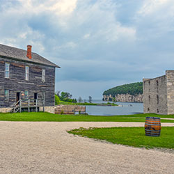
Location: 4785 II Road | Garden, Michigan 49835
Phone: (906) 644-2603
Fayette was once one of the Upper Peninsula's most productive iron-smelting operations. Located on the Garden Peninsula at Snail Shell Harbor. When the charcoal iron market began to decline, the Jackson Iron Company closed its Fayette smelting operation in 1891. It is now a completly restored village including 22 historic buildings, museum exhibits and the visitor center, which can be toured May through October. The historic site is located in Fayette State Park. Approximately five miles of hiking trails — also available for cross country skiing in the winter — wind throughout the historic site and through a hardwood forest providing fantastic glimpses of adjoining Snail Shell Harbor or Big Bay de Noc. Another highlight is hiking atop the Fayette bluff for a scintillating view of the harbor and townsite. The blue water and sky and the white limestone cliffs also provide excellent photo opportunities.
- Fayette Historic State Park [Visit Manistique]
- Fayette Historic State Park [Michigan DNR]
- Fayette Historic Townsite [Michigan History Center]
Bruno's Run Trail
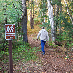
Location: The trail may be accessed from both Widewaters and Pete’s Lake campgrounds as well as from Forest Highway 13 at Moccasin Lake and Forest Road 2173 at Grassy Lake. Limited parking is available at each site.
The 9 mile loop Bruno's Run Trail winds its way past a host of small lakes etched in this relatively young glacial plain, taking hikers, bicyclists, snowshoers and skiers over gently rolling country. Further along, the trail runs over foothills, along overlooks and through valleys. The many lakes and streams in the area as well as a variety of trees and other plants make it likely that those traveling the trail will spot wildlife or tracks. If you are alert, you are sure to have an enjoyable outing. Permits are not required for camping along the trail or for campfires. Be careful with fire.
- Bruno's Run Trail [Hiawatha National Forest]
- Bruno's Run Map [ 262kb]
Colwell Lake Trail
Location: 30 Miles North of Manistique just off of M-94
Colwell lake is 145 acres with an excellent swimming beach and boat access. Camping, fishing, picnicking and hiking are other popular recreation activities at Colwell Lake. The Colwell Lake Trail begins at the boat launch parking lot. This natural surface, nature trail is 1.6 miles long and crosses through a variety of northern hardwood stands and wetlands. The trail has several areas where stairs or plank boardwalks are traversed.
- Colwell Lake Hiking Trail [Hiawatha National Forest]
- Colwell Lake Hiking Trail Info & Maps [Manistique Tourism]